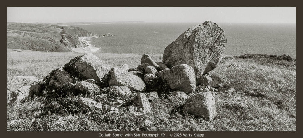
In July of 1987 I heard of an intriguing “stone wall,” some megalithic stones and mounds on Tomales Point at the extreme northern area of the Point Reyes Seashore. A friend told me I would find these mysterious stones if I was attuned to their presence––they would beckon me. Having had a long fascination with stones and their alignments with the seasons and the risings and settings of celestial bodies, I wondered about this site. On that late July afternoon, I brought my camera and headed out to the trail to take a look. The following photo essay reveals what I found there thirty-seven years ago, followed by what I saw on a subsequent visit last January.
IMPORTANT NOTE: IF you visit this site please be respectful. Do not disturb or deface in any way the stones you see there. These stones are sacred to certain indigenous peoples.
There are two predominant theories about the stones and their origin on the Tomales Point Trail. One theory hypothesizes that the lined-up stones are property lines from ranching in the 1800s. The other proposes that they are far older and serve as “stepping off stones” for the spirits of indigenous peoples to journey in the afterlife to the Farralon Islands or perhaps to Mount St. Helena. Both places are visible from the highlands of Tomales Point. Neither of these theories have conclusive proof to back them. For now, the history and purpose of their construction remains a mystery, a compelling one!
First Visit to Tomales Point Trail
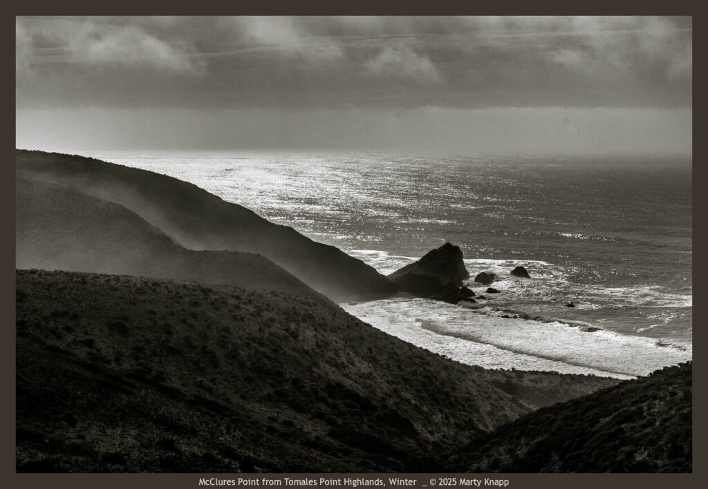
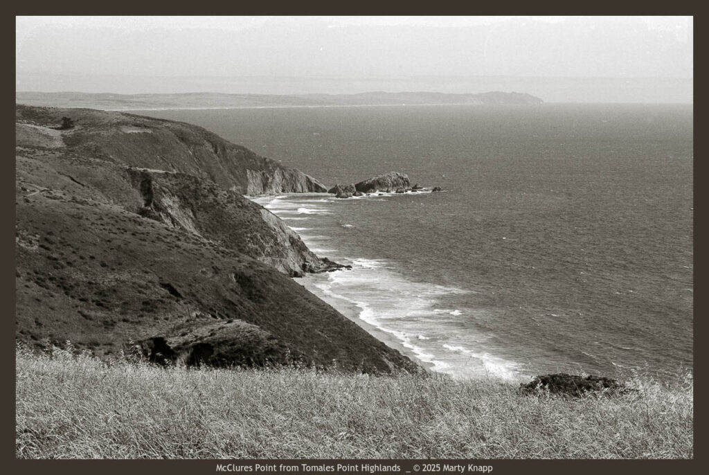
On my first visit in 1987, I hiked up the long grade and at first noticed no interesting stone formations. I did, however, gain a spectacular overview of the rocky point at McClures Beach to my south.
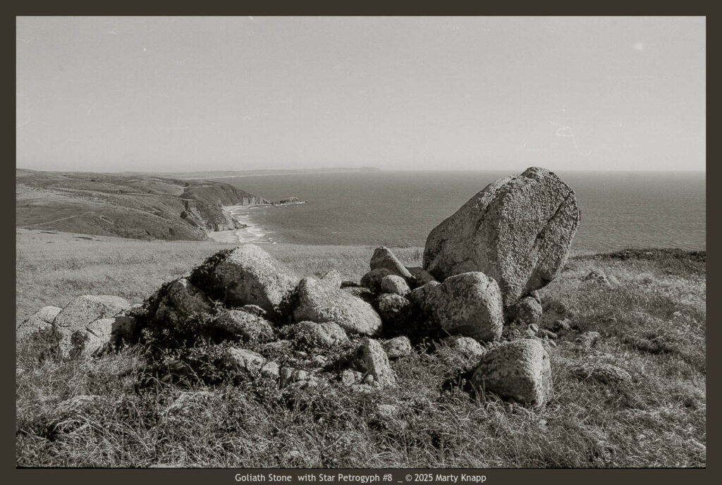
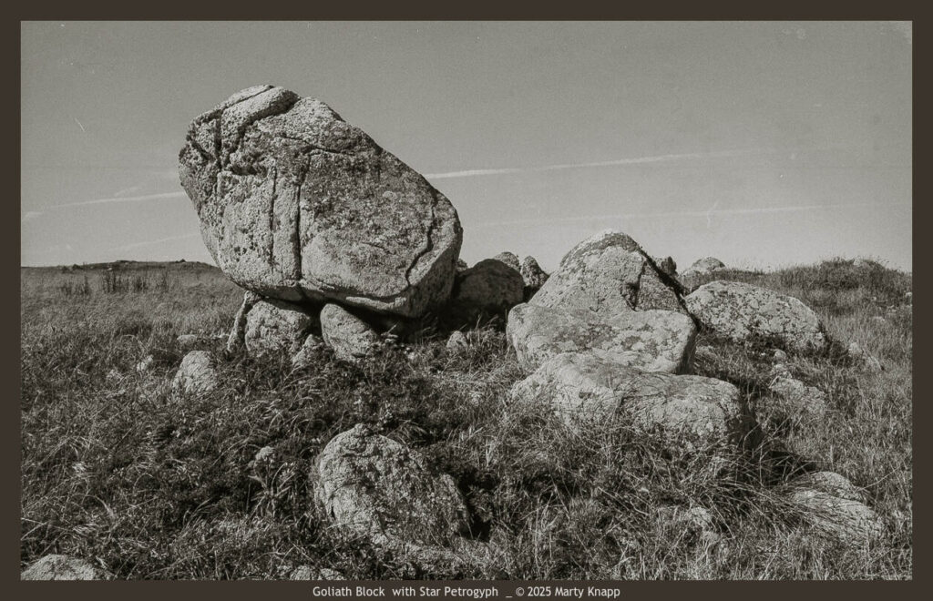
As I was nearing the plateau of Tomales Point, I saw a striking monolithic stone to the west of the trail. Drawn by its presence, I walked toward it for a closer look. I was moved to photograph it. I recently learned that this megalithic stone has a name––Goliath! I didn’t notice at the time that there was a 6-pointed star petroglyph carved into its west-facing side. I also recently noticed, while taking a closer look at this early photograph, that the petroglyph side of the stone seemed unusually flat as though it had been somehow carved down.
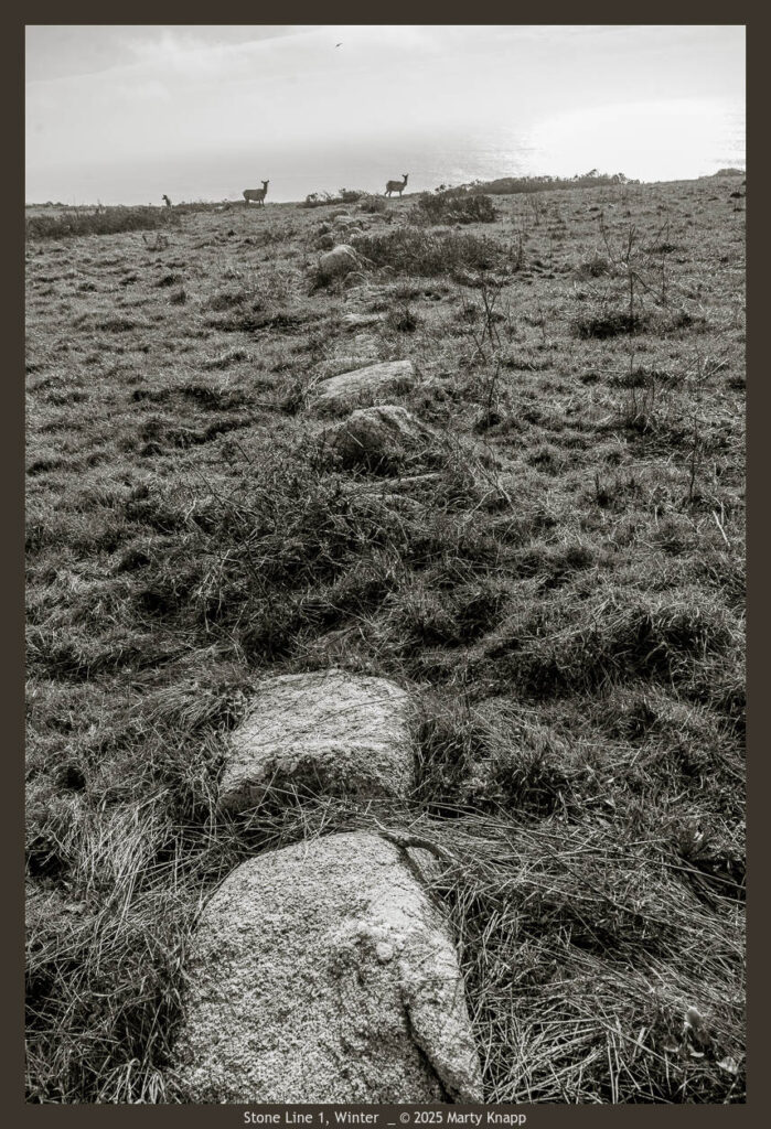
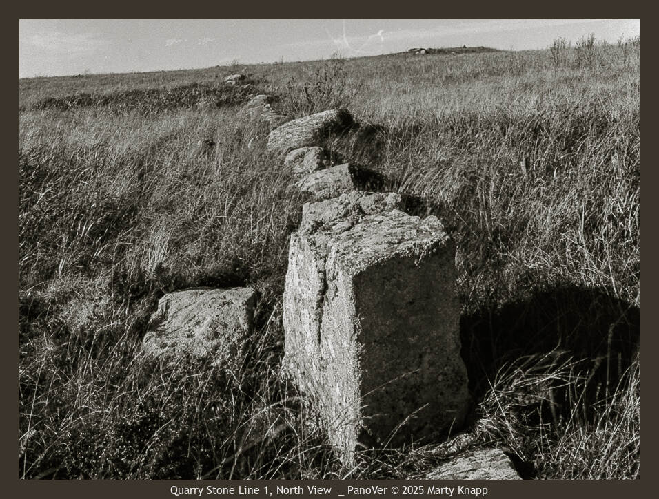
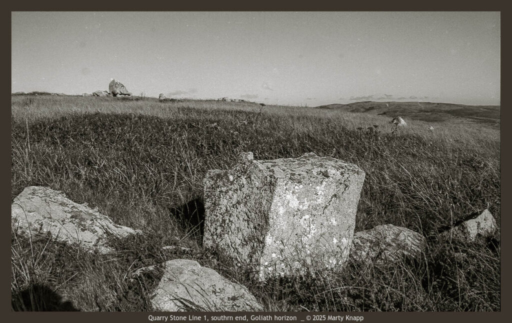
I returned to the trail, wondering where the so-called “stone wall” was. In about a hundred yards, I walked right through it. If I hadn’t been scanning the horizon left and right I might have never noticed it. What I discovered was the wall was more of a “stone line.” At the trail the line of stones was interrupted and continued on the other side of the path in a line heading in a more easterly direction. Both lines were exceedingly straight. I wondered if they pointed at a visible geographical feature. Most of the stones were submerged and barely visible. Every so often a larger rock stood up like a beacon. I made a couple of photographs featuring one of the larger stones that looked like it had been chiseled into a cube!
Returning: January, 2024
I had been thinking of returning to this site for a couple of years and so, on a January morning this year Jean and I went to visit this unusual place. The trail seemed much steeper than I remembered it, and well, it had been thirty-seven years since I walked it. On the way I up, I paused to photograph the overview of McClures Point. The winter view is darker, more somber.
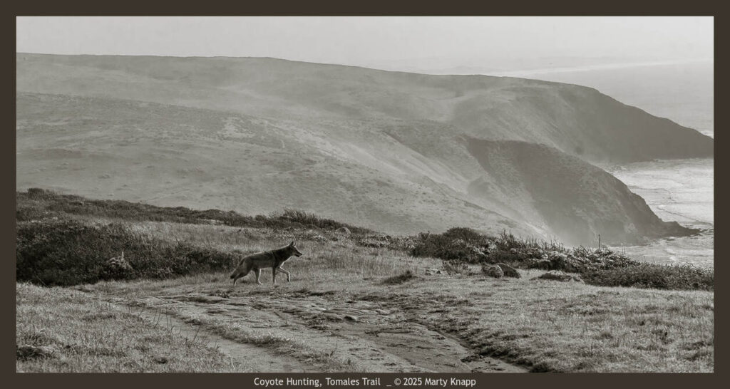
Further up, we saw a healthy coyote, hunting.
Somehow, I walked right past Goliath and ended up at the stone line, where I made a quick documentary photo.
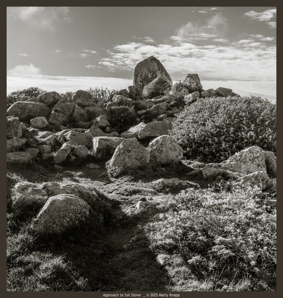
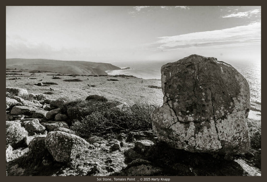
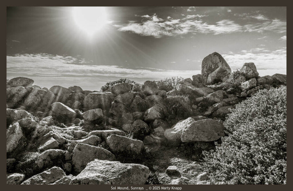
We then looked toward the north, and saw a mound of rocks. We later learned it is called the Sol Mound; from there you can observe the sun clearly, throughout the year, setting and rising, on every horizon. As we approached the elevated mound, one rock stood out––the Sol Stone.
Here are two views from the top of the mound.
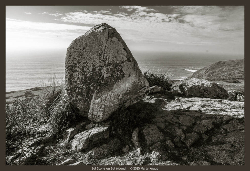
Upon leaving the Sol Mound, I turned to look at it one more time. We talked about coming back sometime soon for another visit.
Beautiful photographs.
Geologist Steve Janes and I have been researching this area for multiple years now. My specialty is sacred places. We’ve written blogs and now a book about it, if you’re interested.
The stone line is the path of the dead.
https://www.sacredamerica.org/2021/11/spirit-paths-and-sacred-places-point.html
An intriguing place, Marty, made even more special through your photographs. Kathy and I will have to go there to visit the rocks.
I have walked that path several times and have always thought the Goliath stone site looked liked a ceremonial spot. In fact I think some couples have been married there. Something sacred calls one. No question – it did to me.
Ahhhh. So good to be reminded that we descend from a long line of observers, who mark their presence and record their energy with whatever tools are available, for some it is stones and chisels, for others, marvelous photographs–etching our passage.
Kathleen,
Thank you for this kind comment.
Marty
Hi Marty,
As a european, my view of North America is very much founded on the notion that it’s the “New World”. Here in the UK and elsewhere in Europe, we have a plethora of reminders that the ground on which we live has been inhabited for millennia. Stone circles, of which Stonehenge is but one, appear all over the continent, within the tiny island that is the UK, they exist from the Ness Of Brodgar in the Orkney Islands to the north of the Scottish mainland ( and which predates Stonehenge ) to Bodmin Moor in the south west of England. I have seen monoliths in France and Spain and Dolmens in France, Germany the UK and Channel Islands. Skara Brae in the orkneys is a well documented Neolithic village.
We in Europe know so little of the early settlements of humanity in continent of the UK. Every time I visit the USA I find some obscure Native American Tribe whose existence I was previously unaware ( the coastle Miwoks are a case in point.). Its is illogical (to quote Spock) that neolithic and paeliolithic peoples would Not have inhabited the “NewWorld” millennia before the “discovery” and “colonisation” by Europeans.
These photographs are evidence of Something. I hope American prehistorians can raise their eyes from the study of prehistory (you are blessed by some of the finest fossil “finds” in the world) to open up the enigma surrounding the earliest settlements off the continent.
Thomas,
Thanks for this comment and reminding us that there are events and civilizations that predate all our recorded history. Yet, the history can be revealed us in the stone monuments they have left for us to see.
Wow! I had no idea. Thank you so much Marty!
So very interesting! I will forward your email to my daughter who loves that hike and I bet has never thought much about these stones.
Beautiful shots, Marty. I’m reminded that I did an article on the wall once upon a time in the Light. To me, the most curious things are/were:
1) The wall, as you note, was clearly not tall enough to keep livestock separate. So it must have had another purpose.
2) It appears on the earliest known map of Pierce Point.
3) The segment running between the trail and Tomales Bay points directly at Mt. St. Helena, 40 miles away. The mountain was a source of obsidian, which was was highly prized by the Miwok.
4) Otherwise, stone walls weren’t a Miwok thing. So one idea is that the wall predates them too. You mention the petroglyph; there are some stone carvings on rocks in the East Bay that are attributed to pre-Miwok/Pomo peoples.
5) Hooey wooey notwithstanding, it might simply be a mid-19th century field divider or property marker, with rocks from a cleared pasture.
That’s all I remember. Thanks for jostling my way-back machine. I hope you guys have a great new year!
Don,
Thanks for reminding me of your article. I’m pretty sure I read it. I think it included comments from Miwok elder, Lanny Pinole (sp?) who stated that the Miwok oral history states that the stone wall was stepping stones for the spirits of deceased people to either go to the Farallon Islands or Mount St Helena. Using Google Maps and Photo Ephmeris, I was able to ascertain the alignment of the bayside segement to the mountain.
And yes, it seems as though an earlier civilization, predating the arrival of the Coastal Miwok, was the likely makers of the Stone (Lines), if you subscribe to the possibiity that we are looking at an ancient fabrication.
Thank you, Marty and Jean, this is a great story to launch the new year. The photographs are stunning, and the light is magnificent. Is there perhaps another photo with the coyote and a full view of the land abutting the ocean shore? I have a few treasured framed Marty Knapp photos purchased a few decades ago, and will consider a purchase if these images are put into the rotation.
Greetings Marty
What a gorgeous essay on this line of rocks and the two most common explanations you share. I have walked to them nay times, I have read the piece in the Point Reyes light following the “study some high school students did a few decades ago, even trying to measure the depth of these various stones. Even though I am not ready to make a decision as to which the two [or another possible third] explanation to believe, your report here is the best as far as I am concerned. And I never noticed the star on “Goliath”, thanks for sharing. And who told you it was called Goliath and “The Sol Mound”? I love it, bravo!
Emmanuel.
Thanks for your comment on my recent blog about the stones on Tomales Point. INPORTANT NOTE:
Should you or anyone else visit this site, please be respectful and do not disturb or damage what you see there.
The article where I found feference to “Goliath” and the “Sol Mound” is here:
https://www.ancientlines.com/tomales-point/ by Stephen Janes.
According to another source, Lou-Anne (Luan) Fauteck Makes-Marks, Ph.D, (who also collaborated with Janes)
https://www.sacredamerica.org/2021/11/spirit-paths-and-sacred-places-point.html
Janes nicknamed the star-petroglyphed stone “Goliath.”
This site has in depth discussion of customs of the indigenous peoples of the greater area where the stones in question appear.
I need to read this site more carefully as it is well presented and has lots of links to documentations and other writers.
Both of these linked websites are rich with details and well worth looking into.
I haven’t yet tracked down the origin of the “Sol Mound & Stone”
My family has been mystified by these stones as well and frequently visit them, Goliath and the Sol Mound. We didn’t have names for Goliath and the Sol Mound so appreciate your essay. We are better informed.
Beautiful Marty!
Interesting series! This looks like something you might find in Scotland.